At the tail end of the weather forecast on the VHF radio, the only sort we can pick up on Ganymede when away from wifi connections, the recording said “Swell height, two meters.” Now, I don’t know how much a “meter” is, but after looking on the handy conversion chart I keep posted to the bulkhead in case a chart should be printed with “metric soundings”, it seemed impossible. Six foot swells out there? It was calmer than a millpond in Prospect Harbor, and it had been blowing offshore for days. Deciding it must be a mistake, we hauled up a very muddy anchor and sailed out through the maze of bald islands and sunken rocks that guarded the entrance to our entrancing refuge.
On coming out into open water, we found the swell forecast had been, far from an exaggeration, rather an understatement. It was good that we weren’t motoring, since without a good wind to steady the sails, Ganymede would have rolled gunnel to gunnel in the short-period, steep swell. It seems that as lows brush by the coast, the SW winds offshore generate a fearsome onshore swell, even while it’s blowing N or NE in inshore waters. It wasn’t too bad at first, sailing along close-hauled, but toward afternoon the wind came up and pointing was no longer a good option. We had gotten far enough from the shelter of the coast that the wind waves, coming against the SW swell, became really uncomfortable, and an inexplicable swell from the east seemed to be running as well, adding it’s own flavor to the confusion of the seas.

When it became evident that our intended destination would be impossible to make before dark, since it was now 25 miles straight upwind, we tacked an found we could just barely make toward Halifax—not quite, but close enough to maybe get into a lee and have quieter water to work with. Even if we could have made for Jeddore harbor, our intended stop, I hadn’t been relishing trying to enter a narrow river mouth with that kind of onshore swell breaking against the shallow bits. Far better, even if it meant getting behind schedule, to make for a deep, well-marked harbor, one which could be entered in any conditions.

We made it to Halifax well before dark, in the end, with the help of our powerful 8-hp outboard, and found it a stop worthwhile. At the very end of the Northwest Arm is a splendid anchorage suitable for all weathers; a free dinghy dock at the park; and an easy walk to shopping of every sort. We even ate out while there, something we hadn’t done since January. We arrived on Thursday night, and didn’t leave until Tuesday morning—an unprecedented stay for us who like to keep on the move.

Though the swell was not much less, the wind was not opposed to it, so things got along more comfortably, in spite of the thick fog that settled in as soon as we were well underway. This fog was to be our last one for Nova Scotia, though we didn’t know it that day—all we knew was that as the wind increased toward afternoon it only got thicker and thicker. By the time we made our turn at Nichol Island to get into the Ship Harbor approach, you could have scooped it with a spatula. The turn put the wind abeam rather than astern, which always makes it seem to be blowing twice as hard, and I had the added joy of piloting in blind with a photocopy of a chart so old it didn’t have a lat/long grid. Instead I had to plot GPS positions on a larger-area chart with far less detail, then transfer them as best I could to my harbor chart. This was seafaring at it’s finest—rising wind, pea-soup fog, some horror called “Bear Rock” under our lee, and closing fast with a rock-bound shore using a chart drawn before the war of 1812. Suddenly, like I’ve been told it’s famous for doing, the fog ended right near the shore, and everything ahead could be seen as plain as could be.

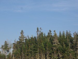
In a little while Ganymede, sails stowed and on an even keel again, lay at anchor in a tiny rock-bound bay in Passage Island. The wind whistled overhead but we were safe and snug, eating an early supper and watching a huge bald eagle sitting over it’s nest on a tall pine tree bear the shore.